
LayerDrone’s Origin: From Trusted Alpha to World’s Largest Drone Network
Author:

Bryce Bladon
Published on
December 5, 2025

LayerDrone didn't start as the world's largest drone network. It started with four professional operators, 320 test missions, and a barely functional app in a small Alberta town. Three years of alpha and beta testing transformed that humble beginning into a protocol spanning thousands of pilots, millions acres, and hundreds of thousands of successful mission flights.
Spexi CEO Bill Lakeland always envisioned breaking the world into standardized quadrants where pilots could capture data consistently. But when he co-founded Spexi with CTO Peter in 2018, the technology and incentive structures didn't exist yet to make this vision scalable.
By 2022, the release and proliferation of the DJI Mavic Mini brought smaller, higher-quality consumer-grade drones to the market. Simultaneously, the DePIN (Decentralized Physical Infrastructure Networks) space introduced new possibilities for incentive models that could scale rapidly.
Throughout 2022, Spexi raised funds for what would become the LayerDrone network. In October 2022, they closed a $5.5 million seed round led by Blockchange Ventures, with participation from Protocol Labs (founders of Filecoin), InDro Robotics, Alliance DAO, FJ Labs, Dapper Labs, and other prominent cryptocurrency investors. The announcement marked the public introduction of the Spexigon: a drone imagery standard, the network’s building block, and ultimately, a DePIN built to standardize aerial data capture at global scale.
In 2023, Spexi began building the supply chain of what would become the LayerDrone network. Eventually, it would become the world's largest standardized drone network.
The first alpha started with rudimentary testing.
Location: Cochrane, Alberta
Duration: Two weeks
Pilots: 4 professional operators, 2-3 Spexi employees
Missions: 320 missions (288 panorama, 32 mapping)
In spring 2023, Operations Manager Graham Anderson and COO Alec Wilson flew early test missions off of their respective rooftops. They used an engineering team-developed mobile application that’s a pale shadow of the current app: The H3 hexagon grid didn't display properly on the map, and there was no visual indication that missions had been completed. They were answering fundamental questions: Would the drone even take off? Would their software communicate through the SDK to control the drone properly?
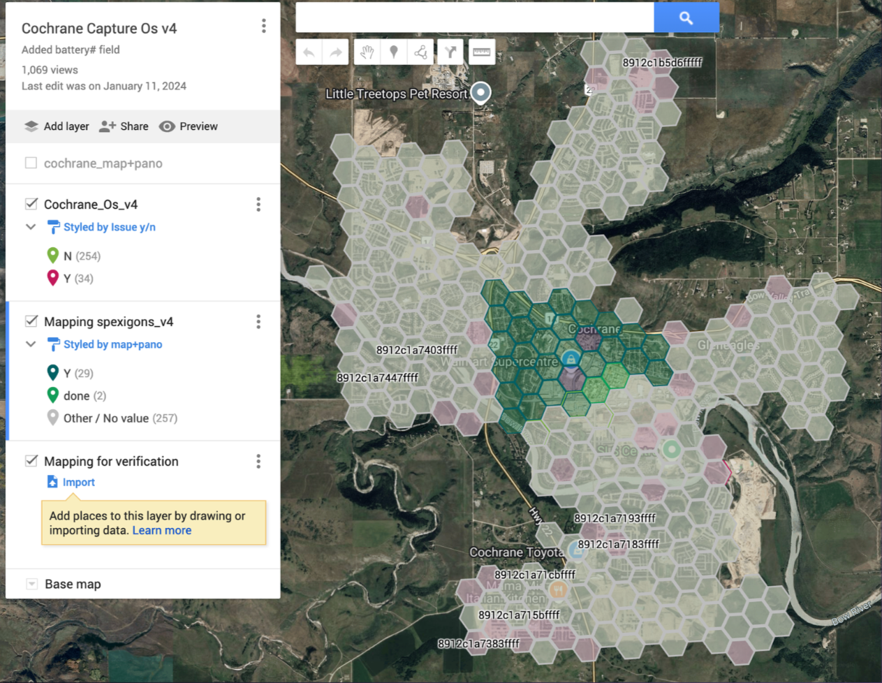
By summer 2023, Spexi was ready for the first structured test. With the City of Cochrane as a client, the Spexi team partnered with Osprey Integrity, a professional drone services company in Cochrane, Alberta. Because the application was unstable and new, they needed experienced operators who could handle unexpected issues—connection losses, incomplete flights, or system failures.
Four pilots coordinated with each other to avoid duplicating work, manually changing colors on shared overlays to indicate which missions had been flown.
The alpha was a resounding success: all missions were completed without incidents, and the imagery flowed through the system as intended.
The next stage of the alpha provided application updates while testing the operational limits of pilots.
Location: Surrey, British Columbia
Duration: Two weeks
Pilots: 22 known pilots (50 registered)
Missions: 2,200 (8x increase from Trusted Alpha)
The Surrey campaign saw eight times as many missions as the Cochrane test, with pilot participation correlating in scale. The application evolved to show pilots what areas had already been covered by the network, eliminating the shared map and manual, colour-coded workaround that was required for pilots to safely fly the Trusted Alpha.
With the application enabling coordination without a Spexi team member intervening, the next campaign tested the limits of pilots as a resource.
Location: Kelowna, British Columbia
Missions: 500
To test pilot supply in new areas without Spexi employees, Spexi launched a campaign in Kelowna, roughly four hours from Surrey. The 500 missions were completed, proving the network could scale beyond direct supervision. It also showcased a novel and somewhat unexpected finding: some pilots were eager to travel and “follow the network” so they could keep flying missions.
The next test of the known user alpha was the most ambitious: having the network cross the border.
Location: United States of America
Duration: Ongoing
Albuquerque, New Mexico was chosen for the first test missions in the US for strategic and practical reasons. In the US, drone pilots are required to have a Part 107 license to operate a drone professionally, and Spexi’s ability to directly intervene in these tests was limited. Alamo Airborne, a professional operator in the area, provided both the local expertise and the geographic coverage Spexi needed to validate the US market.
The private beta phase marked a fundamental shift from testing to operational delivery.
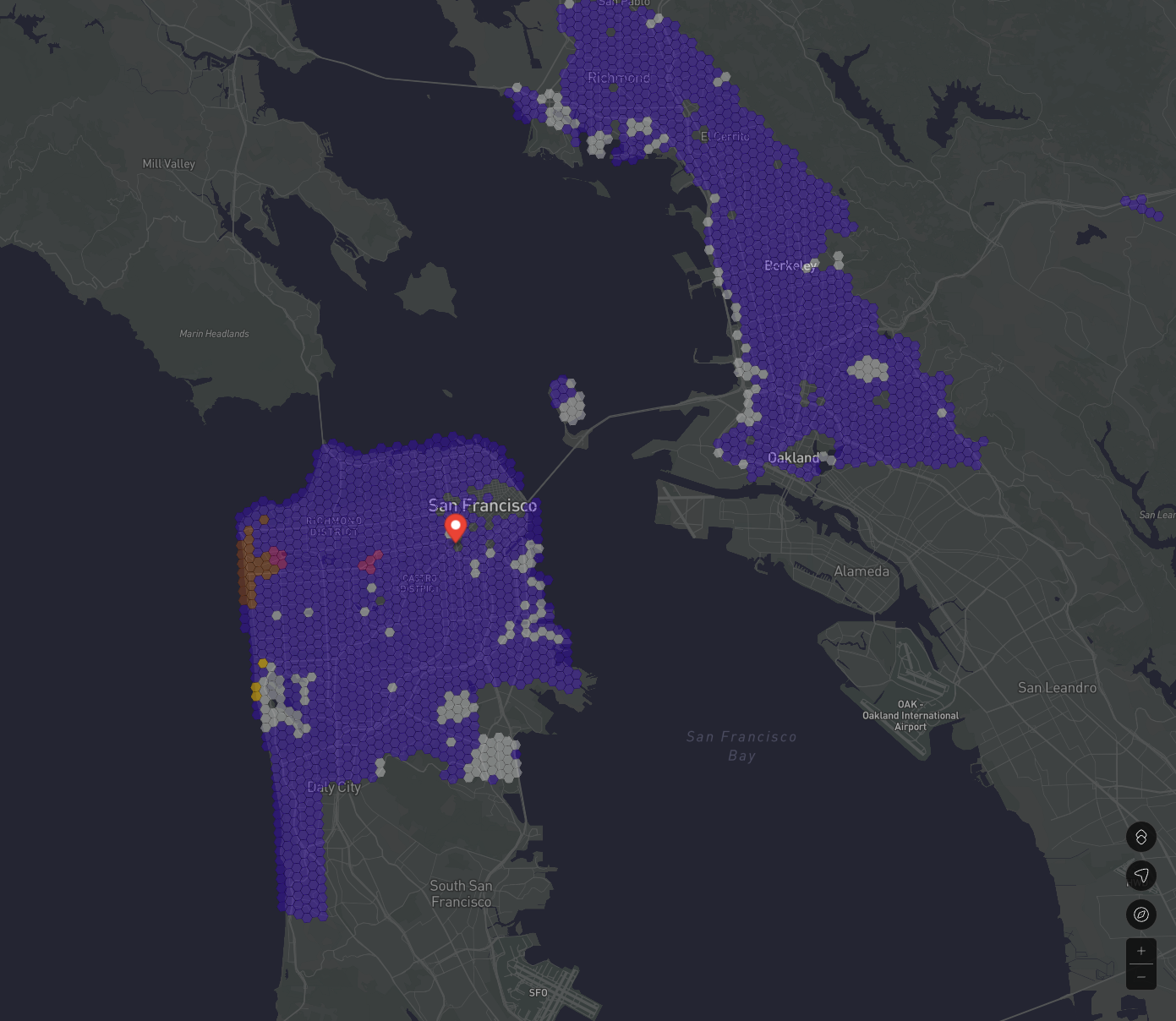
The drone operator who ran the network’s first tests in Albuquerque then began expanding their tests towards San Francisco, California. Spexi Operations Manager Graham Anderson even earned his Part 107 so he could help conduct some of the network’s first San Francisco test flights. At the same time, initial missions were launched in Austin, Texas, to complete US market testing.
On the northern side of the border, Spexi struck a partnership with the Government of British Columbia to image urban environments across the province. This government partnership validated both the network's technical capabilities and its value for public sector applications. It also meant every municipality in the province of BC is now on the LayerDrone network.
By the end of private beta, the standardization strategy that would define LayerDrone's competitive advantage was fully realized:
"One of the unlocks in the drone industry that Spexi—that LayerDrone—is shooting for that I haven't seen anyone else sort of dial in on is that standardization… We have one product that we are building for and that we offer that we think is of enough value to enough users that we can create a global application that will deliver this data type."
- Graham Anderson, Spexi Operations Manager
At the end of 2024, the network went into Public Beta after the Spexi app entered the Google Play Store having achieved the following milestones:
The public beta marked LayerDrone's emergence as the first autonomous aerial data protocol, and the world's largest standardized drone imagery network.
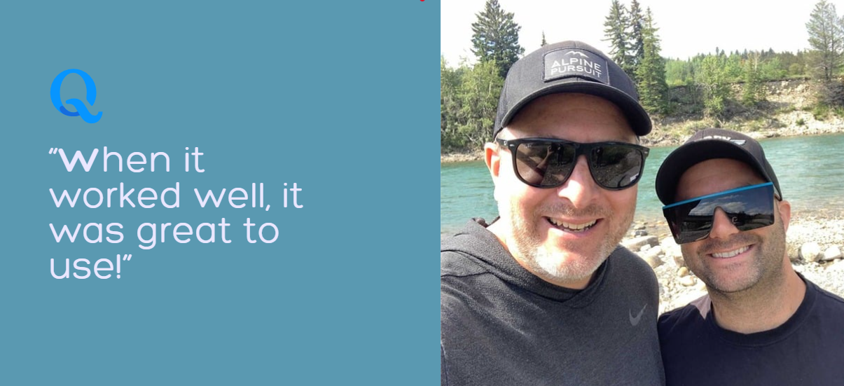
"We couldn't have built what we built without pilots trialing and testing and feedback… These step-by-step iterations could not have happened without these pilots being early adopters of a new technology."
- Graham Anderson, Spexi Operations Manager
In April 2025, the LayerDrone Foundation was established to steward the protocol's decentralization and long-term governance. Moving forward:
By end of 2025, LayerDrone has already achieved over
LayerDrone’s token launch represents the culmination of a three-year journey from trusted alpha to global network. As LayerDrone approaches this milestone, the community metrics tell the story of sustained growth:
From four professional operators flying a few hundred missions in Cochrane to thousands of pilots imaging millions of acres across North America, LayerDrone has built not just the world's largest drone network, but the world's first truly standardized aerial intelligence infrastructure.
The vision Spexi CEO Bill Lakeland outlined in 2018—breaking the world into standardized quadrants where any pilot could contribute consistent, high-quality data—has become reality. What began as test flights off a garage roof in Vernon, BC has evolved into a network reshaping how organizations access and utilize aerial intelligence.
The alpha is over. Mainnet is coming soon, but the network is already taking flight.

USDC rewards are now live on the LayerDrone Network.

From March 14th to March 16th, new missions and mission reservations will be paused to prepare for USDC rewards.