
The Autonomous Aerial Data Network

LayerDrone is the first autonomous drone network producing a standardized, always-updated, high-resolution Earth data layer for robotics and AI

of high-resolution imagery
on the network
by drone pilots
The LayerDrone Token
Powering the world’s largest drone network.
The LayerDrone token will reward network contributors, and will be used by network users to access LayerDrone imagery.

LayerDrone is a community of drone pilots collectively building and upgrading the world's most valuable imagery resource—forming the foundation for spatially-aware AI.
Contribute to LayerDrone
LayerDrone tracks two kinds of contributions to the network: community support (XP), and drone pilot data (RP).

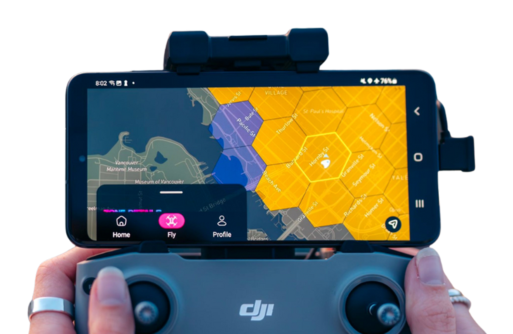
Fly with Spexi: Powered by LayerDrone
LayerDrone is the world’s first “FLY-TO-EARN” network, with drone pilots and other network contributors receiving rewards for their contributions to the ecosystem.
Spexi is LayerDrone’s founding core contributor, and has built an app which interfaces with LayerDrone’s network to enable drone pilots to contribute data and receive rewards all while following LayerDrone standards.
How LayerDrone Works
LayerDrone is the world’s largest fully standardized drone imagery network. It rewards drone pilots for flying and uploading verified imagery contributions at scales.
Drone pilots complete autonomous imaging missions
Blockchain verification ensures data quality and immutability
Data access is provided through Spexi’s app and API
Network governance is shaped by its participants

What LayerDrone Enables
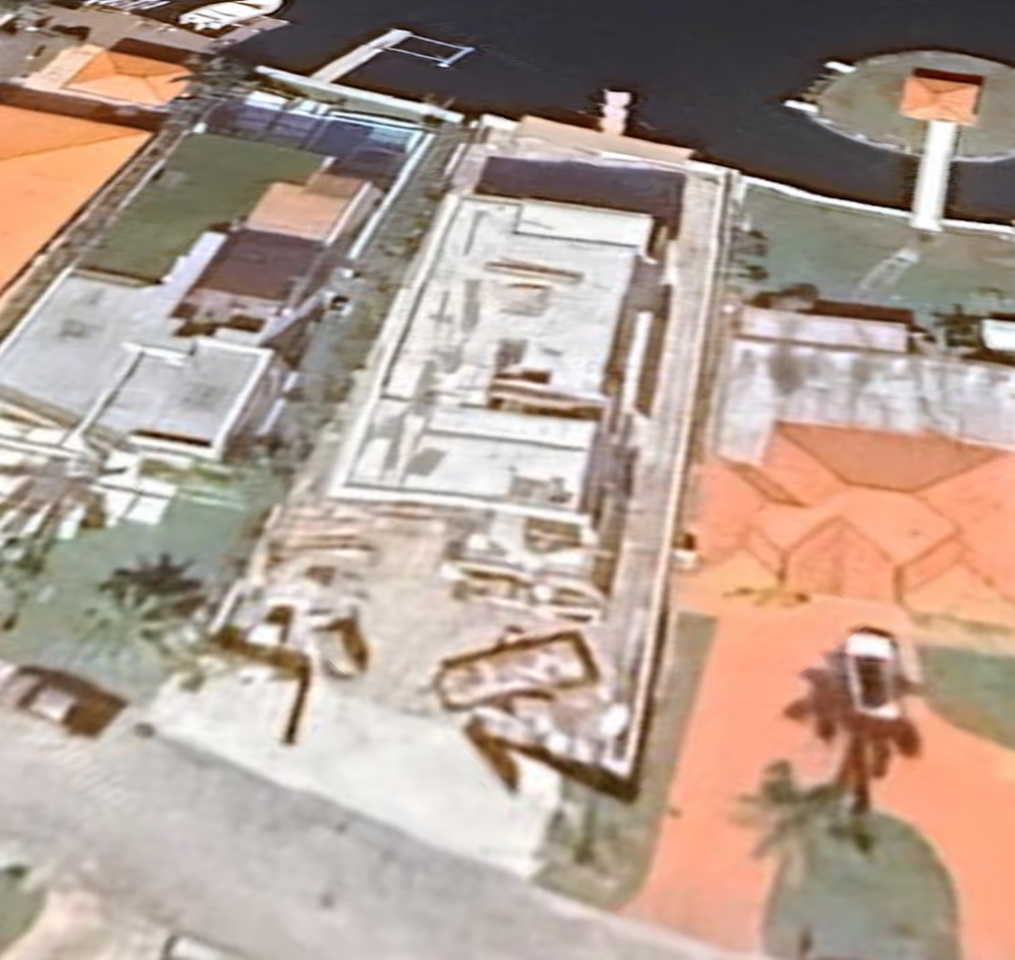
LayerDrone delivers Earth’s most detailed spatial imagery by standardizing space via 25-acre hexagons called “Spexigons”. Drone pilots with sub-250g drones use the Spexi app to autonomously capture high-quality imagery of each Spexigon. Pilots receive rewards for their contributions to the network.
30x higher resolution - For unmatched clarity and precision.
200x faster - Skip the delays. Access imagery on demand.
50x more affordable - Only pay for areas that matter to you.
97% less carbon emissions - Smart and sustainable.

$385B
$872B
The Foundation For Spatial AI
By standardizing ultra-high resolution drone imagery and indexing it for precise location, the LayerDrone Network enables
A global spatial AI model that can 'understand' the physical world
AI systems that can reason spatially and navigate real environments
Applications that bridge digital intelligence with physical reality
An open ecosystem where anyone can contribute or build applications
By building an open network protocol rather than a closed platform, LayerDrone is creating the conditions for massive innovation in spatial AI—similar to how open internet protocols enabled the explosion of web applications.
With the network expanding rapidly—launching in new cities every day, and aiming for over 10,000 missions monthly—I’m excited to keep flying with LayerDrone.

How LayerDrone Helps


Spatial AI
Provide standardized, ultra-high resolution aerial data to train next-gen AI models to operate in the physical world.

Urban Planning
Enable detailed analysis of infrastructure, zoning compliance, and development monitoring.
Environmental Monitoring
Track changes in forests, waterways, and urban areas to prevent wildfires and assess flood risks.

Insurance & Risk Assessment
Conduct detailed property assessments and expedite claim verification processes.
Digital Twin Creation
Build ultra-realistic citywide digital twins for metaverse and simulation applications.

Roadmap
